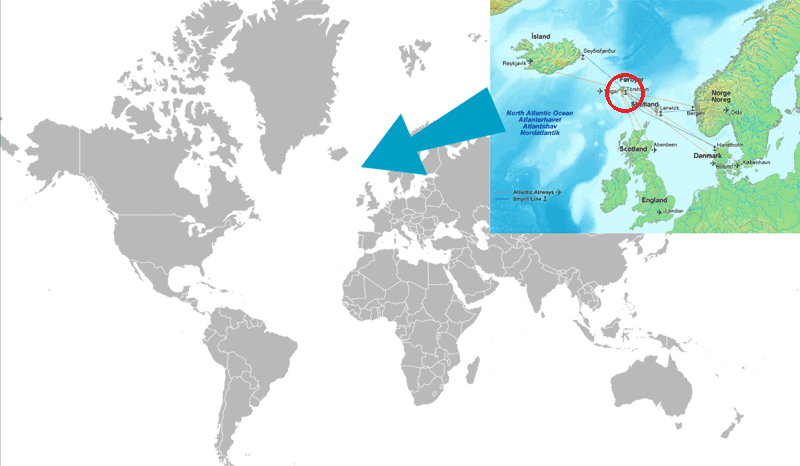
The Faroe Islands are a group of 18 islands in the North Atlantic. They are located between Scotland and Iceland, about halfway from Norway to Iceland.
Take a look at the map below:

As you can see, the countries surrounding the Faroe Islands are: Scotland, Iceland, Norway and Denmark.
The Faroe Islands are part of the Kingdom of Denmark. Denmark’s capital, Copenhagen, lies on about a 2 hour flight.
The capital of the Faroe Islands is called Tórshavn. It has a population of 22,350 people (in 2020 (1)).
Tórshavn is located on the biggest island of the Faroe Islands, called Streymoy.
It’s GPS coordinates are:
Latitude: 62° 00′ 35.03″ N
Longitude: -6° 46′ 17.90″ W
Getting there is best done with a flight from Copenhagen or Oslo. The Faroe Islands have many heliports, but only airport for international flights: Vágar Airport (FAE).
If you have more time, you can travel by boat. It takes 14 hours from Bergen, Norway. If you have even more time, you can travel by boat from Iceland (about 36 hours) or by boat to the Shetland Islands and take a plane from there (2.5 hours).
Read more about traveling to the Faroe Islands.